
The real estate industry is continually evolving, with new technologies emerging to enhance the buying and selling process. One such technological advancement is drone photography, which has significantly impacted how properties are marketed. Drone photography provides aerial views and unique perspectives that traditional photography cannot offer, making it a powerful tool in real estate marketing. This article explores the benefits, applications, and best practices of real estate drone photography, illustrating why it has become a game-changer in the industry.
The Rise of Drone Photography in Real Estate
Drones, or unmanned aerial vehicles (UAVs), equipped with high-definition cameras, have transformed various industries, and real estate is no exception. The use of drones in real estate began gaining popularity in the mid-2010s as the technology became more accessible and affordable. Today, drones are a standard tool for real estate agents and property marketers aiming to provide a comprehensive view of properties.
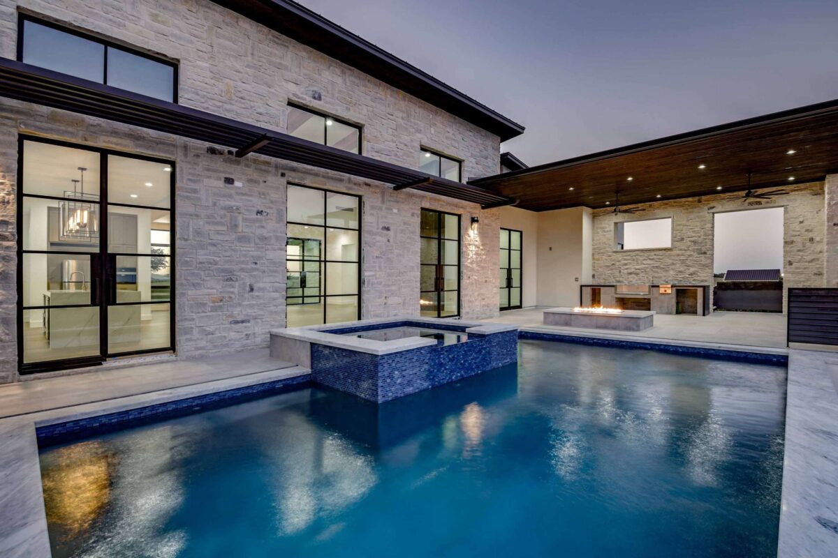
The primary appeal of drone photography lies in its ability to capture stunning aerial shots and videos. These images offer potential buyers a bird’s-eye view of the property and its surroundings, which is particularly valuable for large estates, commercial properties, and homes with expansive outdoor spaces. By showcasing the property’s full extent, including features like gardens, pools, and proximity to other landmarks, drone photography helps create a more engaging and informative listing.
Benefits of Drone Photography in Real Estate
Enhanced Visual Appeal
Drone photography elevates the visual appeal of property listings. High-quality aerial images and videos can capture the attention of potential buyers, making listings stand out in a crowded market. This enhanced visual appeal can lead to increased interest and higher engagement rates, ultimately driving more traffic to the property.
Comprehensive Property Overview
Traditional ground-level photography often fails to capture the entire scope of a property, especially for larger estates or properties with significant land. Drones can provide comprehensive aerial views, offering a complete picture of the property’s layout, including land size, landscaping, and the relationship of structures to one another. This comprehensive overview is invaluable for buyers, giving them a better sense of the property’s scale and features.
Showcasing Unique Property Features
Drones can highlight unique features that might be difficult to capture with standard photography. For example, a drone can showcase a home’s proximity to scenic views, waterfronts, parks, or other desirable amenities. It can also provide dynamic views of architectural features, such as rooflines, terraces, and exterior design elements, that add to the property’s charm and value.
Time and Cost Efficiency
While hiring professional photographers and videographers can be costly, drones offer a cost-effective alternative for capturing high-quality images and videos. Additionally, drones can cover large areas quickly, reducing the time required for a photoshoot. This efficiency can be particularly beneficial for real estate agents managing multiple listings.
Improved Marketing Materials
The dynamic nature of drone footage can enhance various marketing materials, including online listings, virtual tours, social media posts, and promotional videos. The integration of aerial photography can create more engaging and professional-looking content, helping to attract and retain potential buyers’ interest.
Applications of Drone Photography in Real Estate
Residential Properties
Drone photography is widely used for residential properties, particularly luxury homes, estates, and properties with substantial outdoor areas. Aerial images can capture the entire property, including landscaping, pools, patios, and nearby amenities. This comprehensive view helps potential buyers appreciate the property’s full value.
Commercial Real Estate
In commercial real estate, drones are used to showcase office buildings, retail spaces, industrial properties, and development sites. Aerial views can highlight key features such as parking facilities, accessibility, and the property’s location within a commercial district. This information is crucial for business owners and investors considering commercial spaces.
Vacant Land and Development Sites
For vacant land and development sites, drone photography provides an accurate representation of the terrain, boundaries, and surrounding environment. This information is essential for developers, investors, and planners assessing the potential of a site for future projects.
Property Inspections
Beyond marketing, drones are also valuable for property inspections. They can safely and efficiently inspect roofs, gutters, chimneys, and other hard-to-reach areas, providing high-resolution images and videos for maintenance assessments. This capability is particularly useful for large commercial properties and residential complexes.
Best Practices for Real Estate Drone Photography
To maximize the benefits of drone photography in real estate, it’s essential to follow best practices that ensure high-quality results and compliance with regulations.
Hire Licensed and Experienced Drone Operators
Hiring a licensed and experienced drone operator is crucial for achieving professional-quality images and videos. Licensed operators are knowledgeable about aviation regulations, safety protocols, and best practices for capturing optimal footage. They can also handle any technical challenges that may arise during the shoot.
Plan the Shoot Carefully
Planning is essential for a successful drone shoot. This includes scouting the location in advance, identifying the best times of day for optimal lighting, and considering weather conditions. Proper planning ensures that the drone captures the property in its best light, highlighting its most attractive features.
Focus on Key Property Features
To create compelling visuals, focus on capturing the property’s key features, such as architectural details, landscaping, outdoor amenities, and unique selling points. A combination of wide-angle shots and close-up views can provide a well-rounded perspective of the property.
Incorporate Smooth Movements and Transitions
Smooth camera movements and transitions are vital for professional-looking drone footage. Avoid jerky or rapid movements that can make the video difficult to watch. Techniques like panning, tilting, and orbiting around the property can create dynamic and visually appealing shots.
Edit and Enhance Footage
Post-production editing can significantly enhance the quality of drone footage. This includes adjusting lighting and color balance, stabilizing shaky shots, and adding background music or voiceovers to create polished and engaging videos. Professional editing can transform raw footage into a compelling marketing asset.
Adhere to Legal and Safety Regulations
Compliance with legal and safety regulations is paramount when using drones. This includes adhering to Federal Aviation Administration (FAA) guidelines in the United States, such as registering the drone, obtaining necessary certifications, and following airspace restrictions. Safety protocols, such as maintaining a clear line of sight and avoiding crowded areas, are also crucial to prevent accidents and ensure a smooth operation.
Future Trends in Real Estate Drone Photography
As drone technology continues to advance, several trends are emerging that could further revolutionize real estate marketing.
Improved Camera Technology
Advances in camera technology, including higher resolutions, better low-light performance, and enhanced stabilization, will enable even more stunning aerial images and videos. These improvements will allow real estate agents to showcase properties with greater detail and clarity.
3D Mapping and Virtual Tours
Drones equipped with advanced sensors and software can create 3D maps and models of properties. These 3D representations can be used for virtual tours, giving potential buyers an immersive experience and a detailed understanding of the property’s layout and features.
AI and Machine Learning
Artificial intelligence (AI) and machine learning can enhance drone photography by automating image processing and analysis. AI algorithms can identify the most attractive shots, optimize image quality, and even generate marketing materials, making the process more efficient and effective.
Increased Use in Urban Areas
As drone regulations evolve and urban airspace management improves, the use of drones in urban real estate markets is expected to increase. This will allow real estate agents to capture aerial views of city properties, highlighting their proximity to amenities, parks, and transportation hubs.
Conclusion
Real estate drone photography has transformed the way properties are marketed, offering enhanced visual appeal, comprehensive property overviews, and the ability to showcase unique features. By following best practices and staying informed about emerging trends, real estate professionals can leverage drone technology to create compelling marketing materials that attract and engage potential buyers. As drone technology continues to evolve, its impact on the real estate industry is likely to grow, further revolutionizing property marketing and setting new standards for visual storytelling in real estate.